
Doggzeneye ventured up past the (“Indiana Betunada & the Wombat CowSkull Shrine”), or whatever it is. We ventured further/furthur than weave ever weaved, uh, wander/endured before. I imbibed in a substance which (so I think) facilitates removal of filters which impede Nagual perception. Fortunately (?) this condition didn’t last long, and I un-evolved back to what passes for normal.
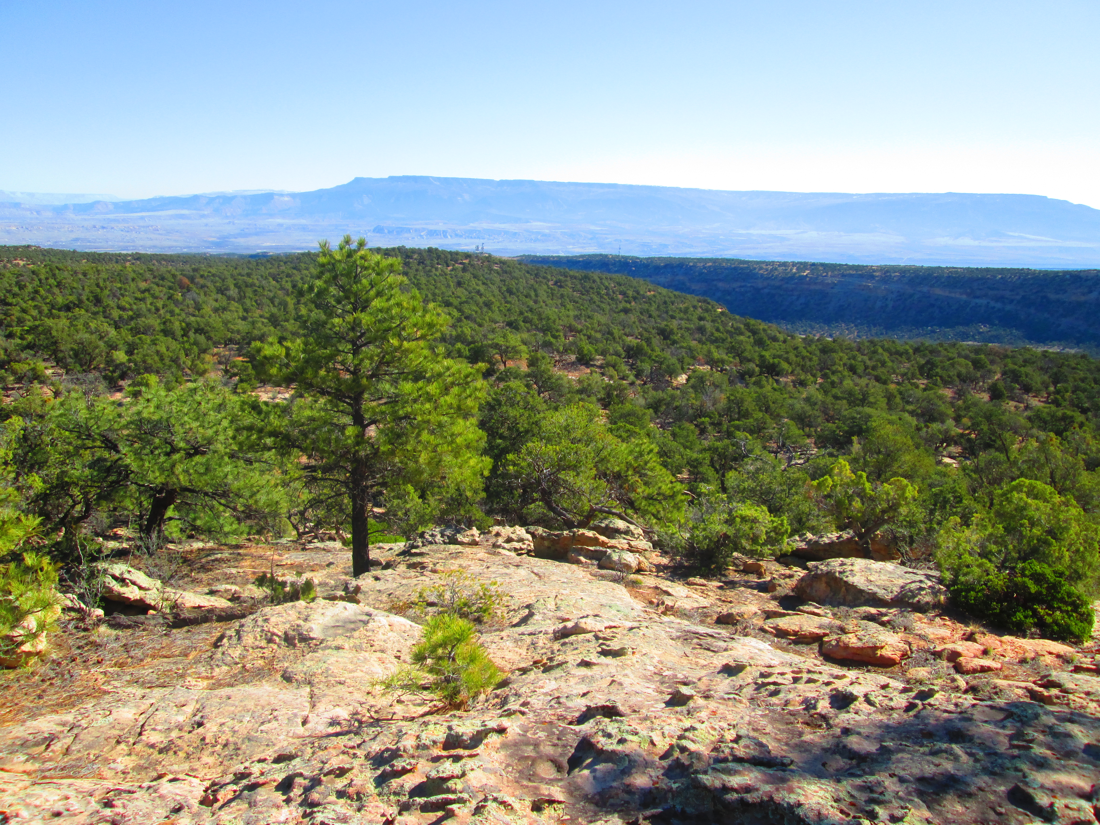
Brilliant day — the unseasonably warm continues (our town broke the record for the date by one-degree. I think it was 78 (f) or so, but fortunately NOT up where doggzeneye were). The occasional cloud passing over the sun resulted in an immediate refreshing drop in temperature. The north slopes during the last mile or so of our trek had snow-bank remnants, so the dogs would cool off and hydrate. Below, The Mesa on the horizon, with the road up to the 9-Mile Hill Microwave Tower ziggin’ lower right up and left.
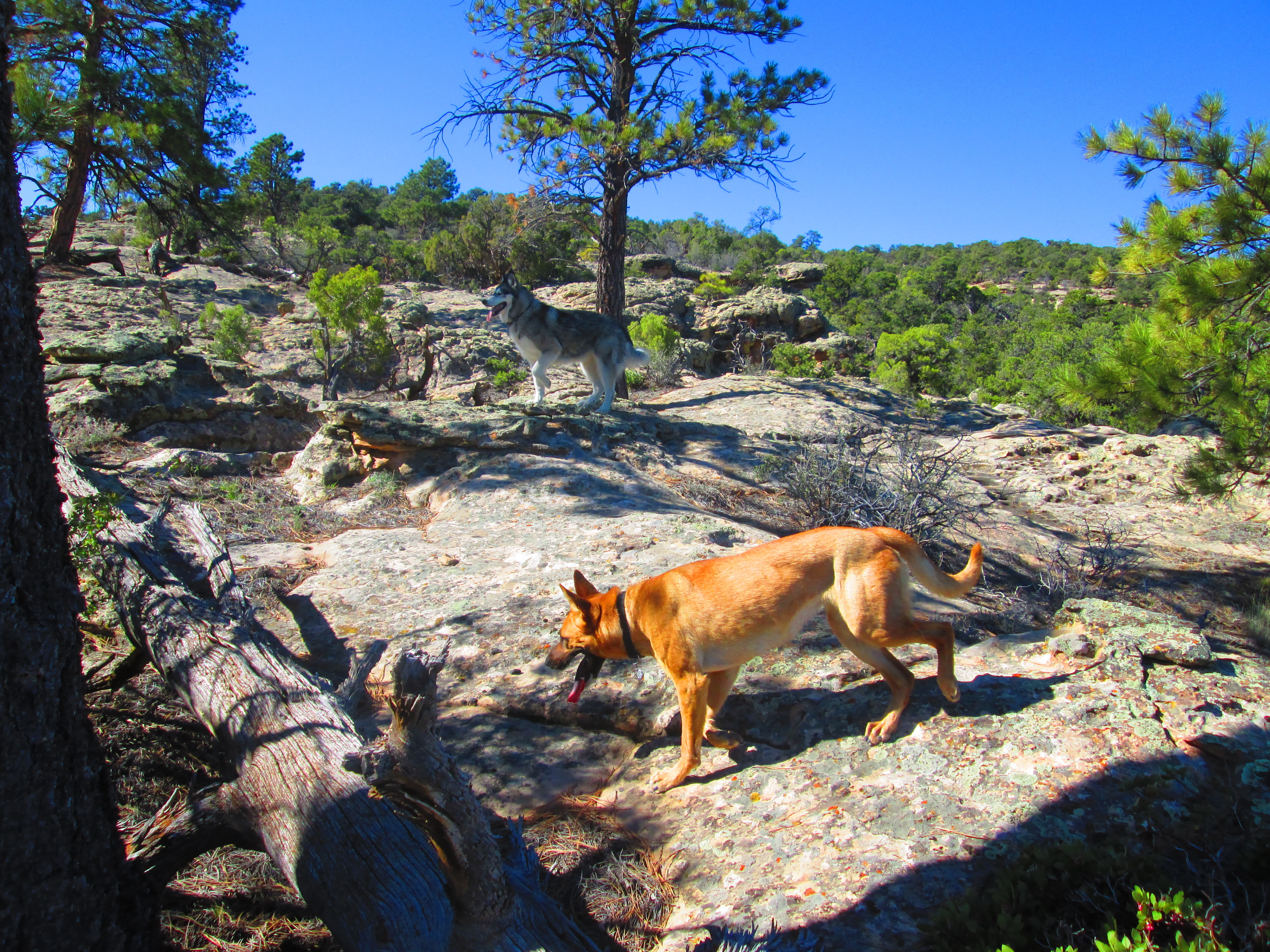
Jaja and Rocksea are, of course, Dogs of the Forest. And I hadn’t been up close and personal with Ponderosa Pines in a while. These are not real giants, yet. Still, I have a sense of awe because in our local forests they are, to me, like royalty. Queens and Kings of the Forest.
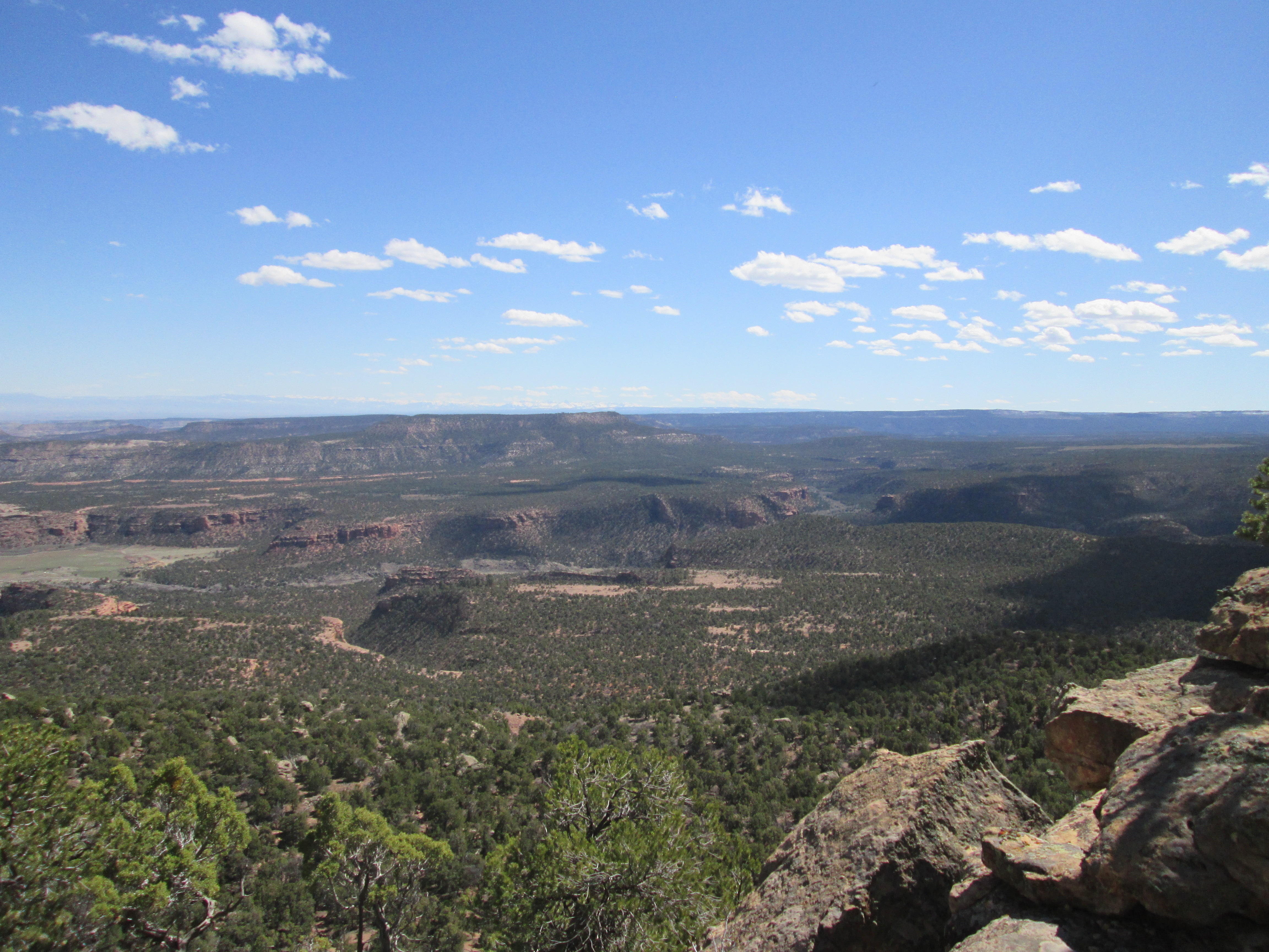
The view below is to the west, with mountains (still snow on them) in the Dominguez Wilderness Area. I call the place I’m in the Olivivas Wilderness Area — as there are no roads, no way for motor vehicles of any sort to intrude — and one is pretty much guaranteed genuine wild-ness. We hike up the ridge north of Unaweep Canyon.
I had forgotten how far I hiked a couple or so years back, trekking through mini-blizzards and worried that I’d run out of light when I encountered the Wombat Cow-Skull clearing.
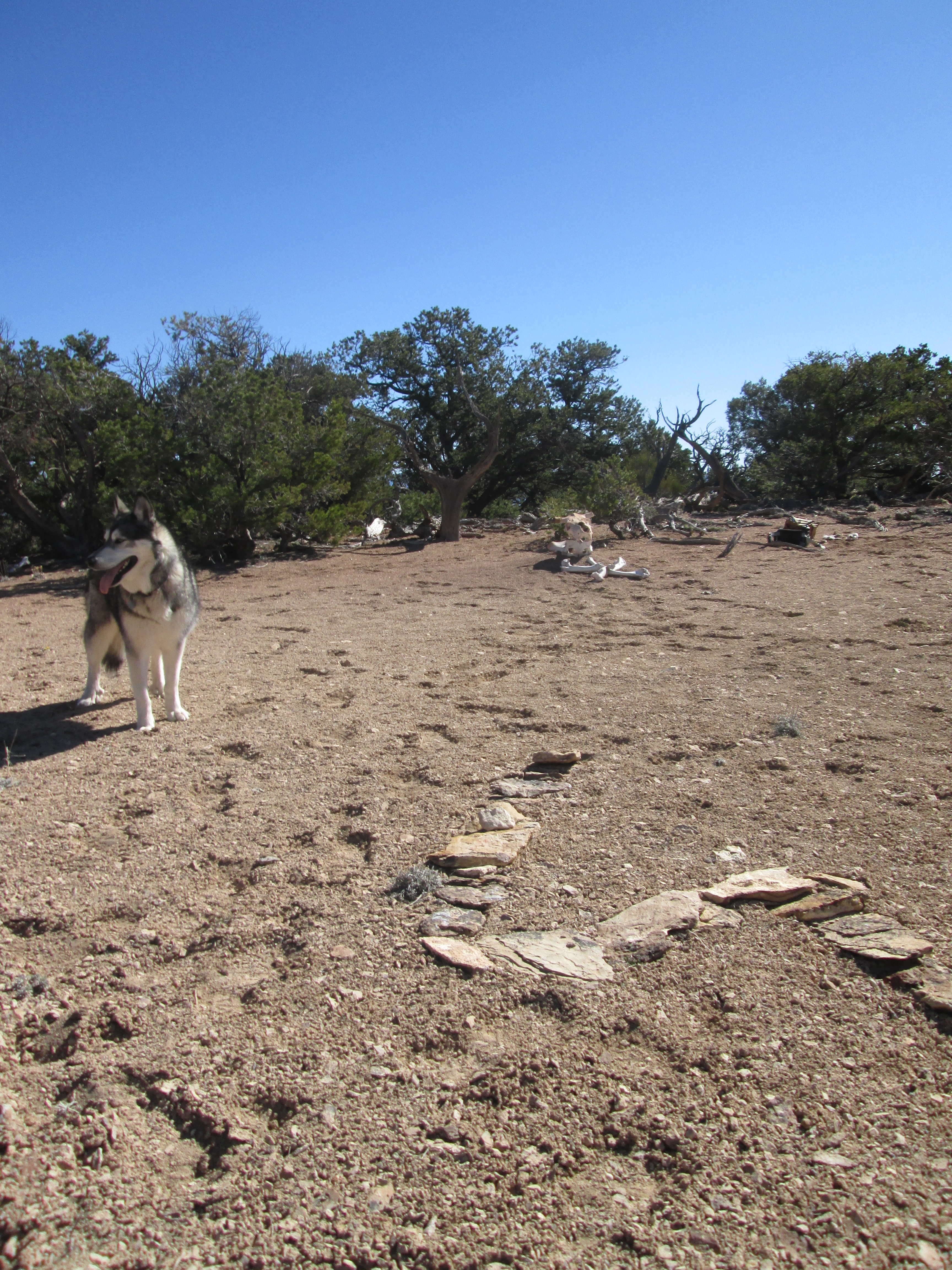
The ‘wombat’ was still identifiable as a wombat, while the skull and bones assemblage begs a question, or three.
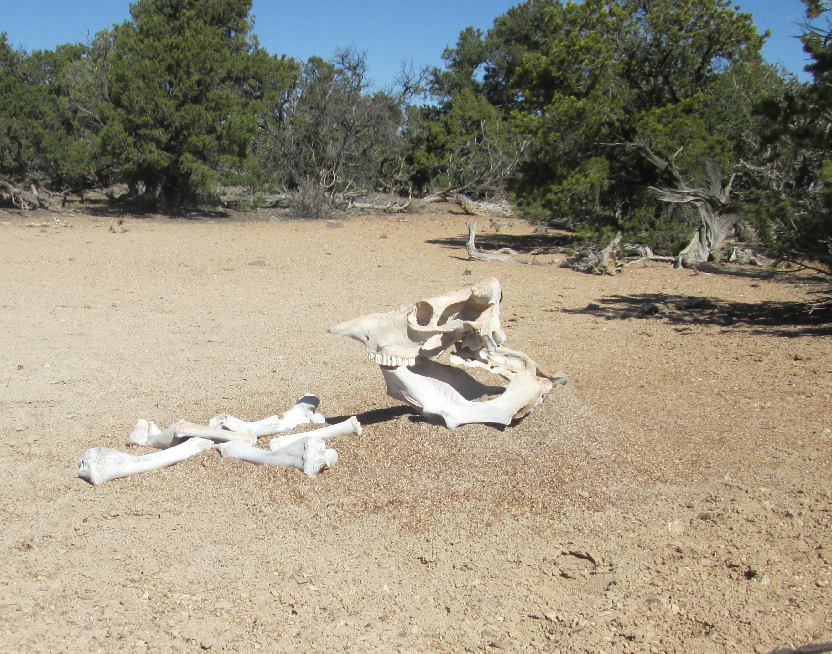
A little further, another clearing with Hormiga-Henge.

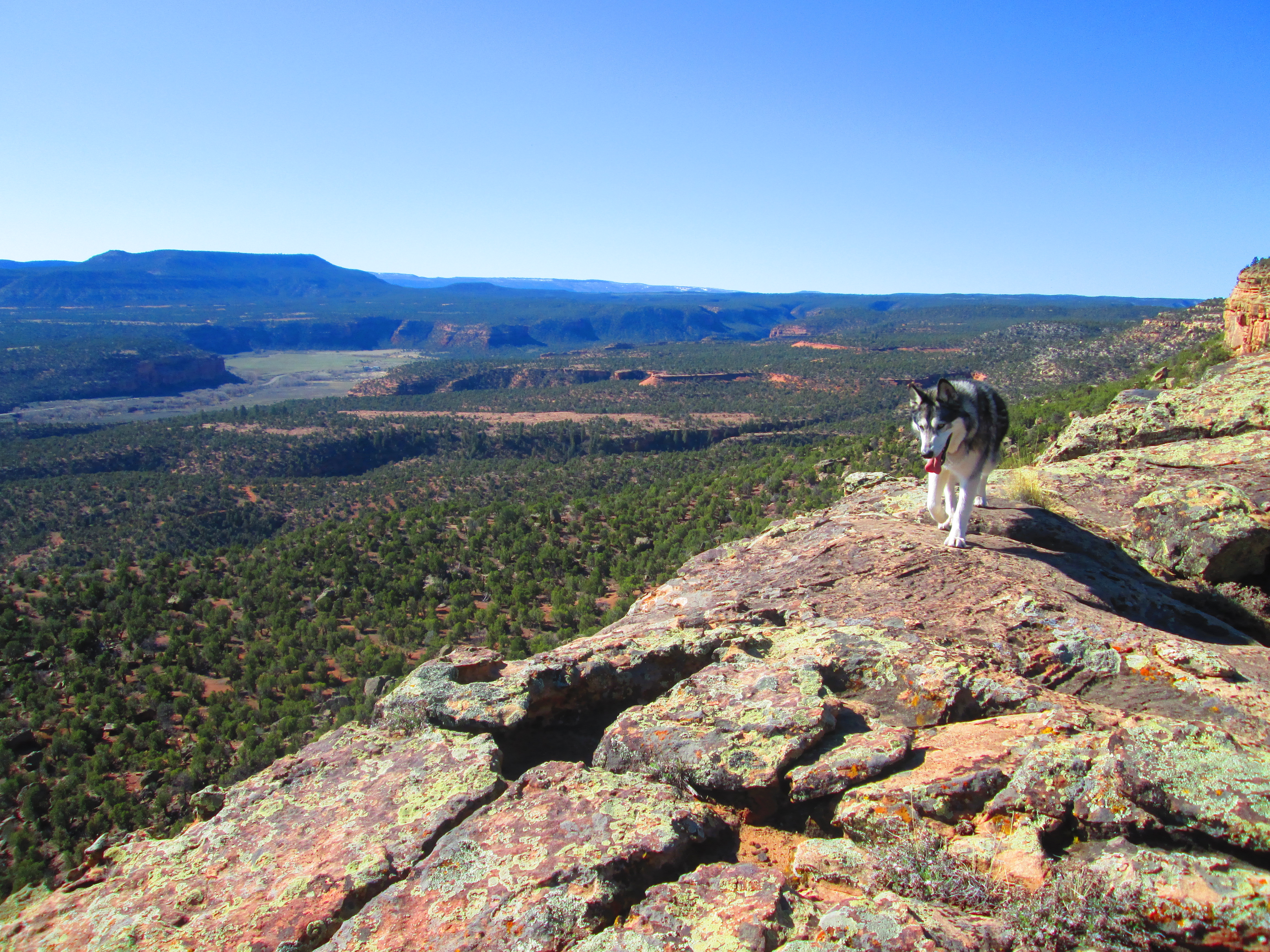
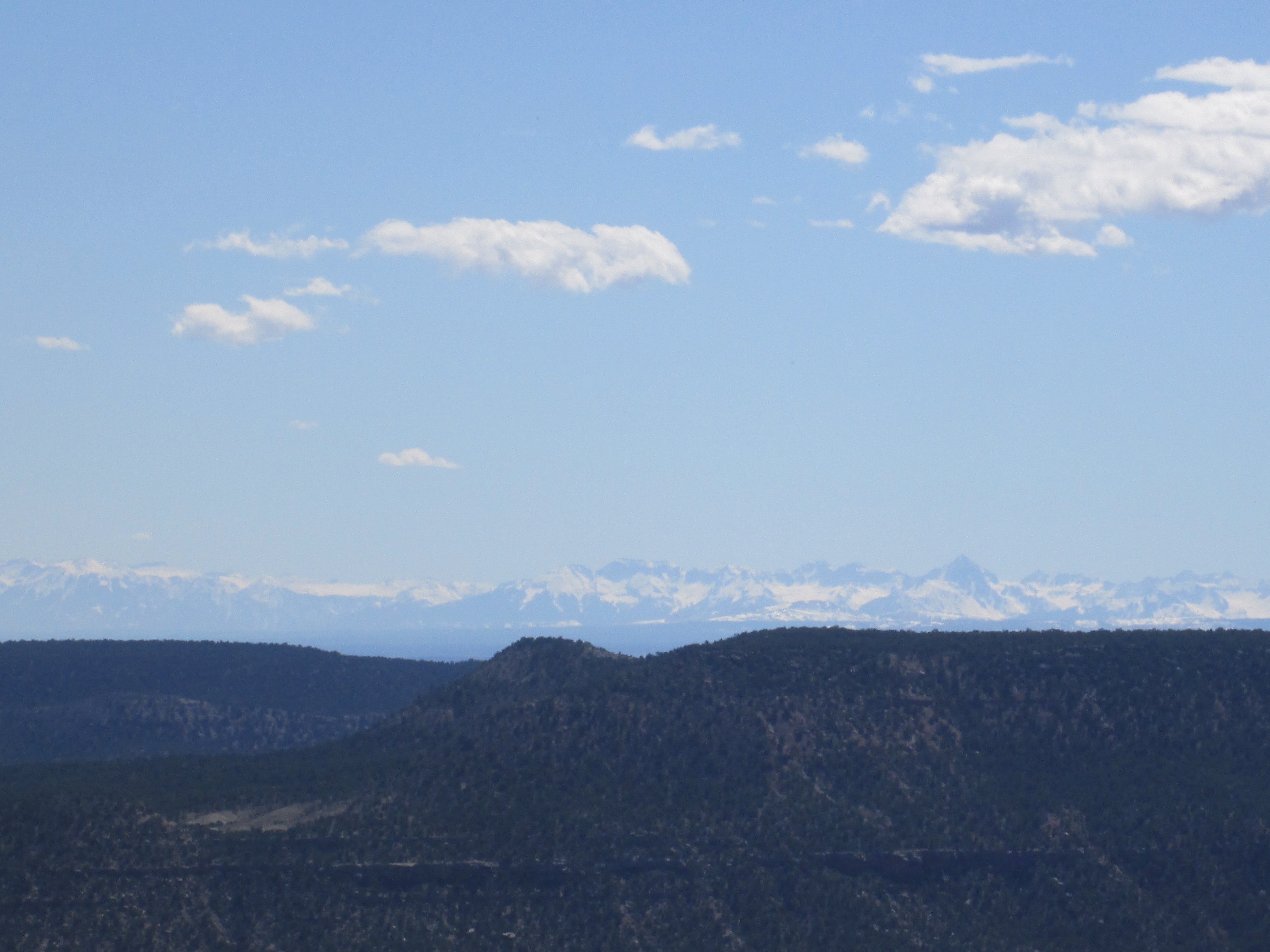
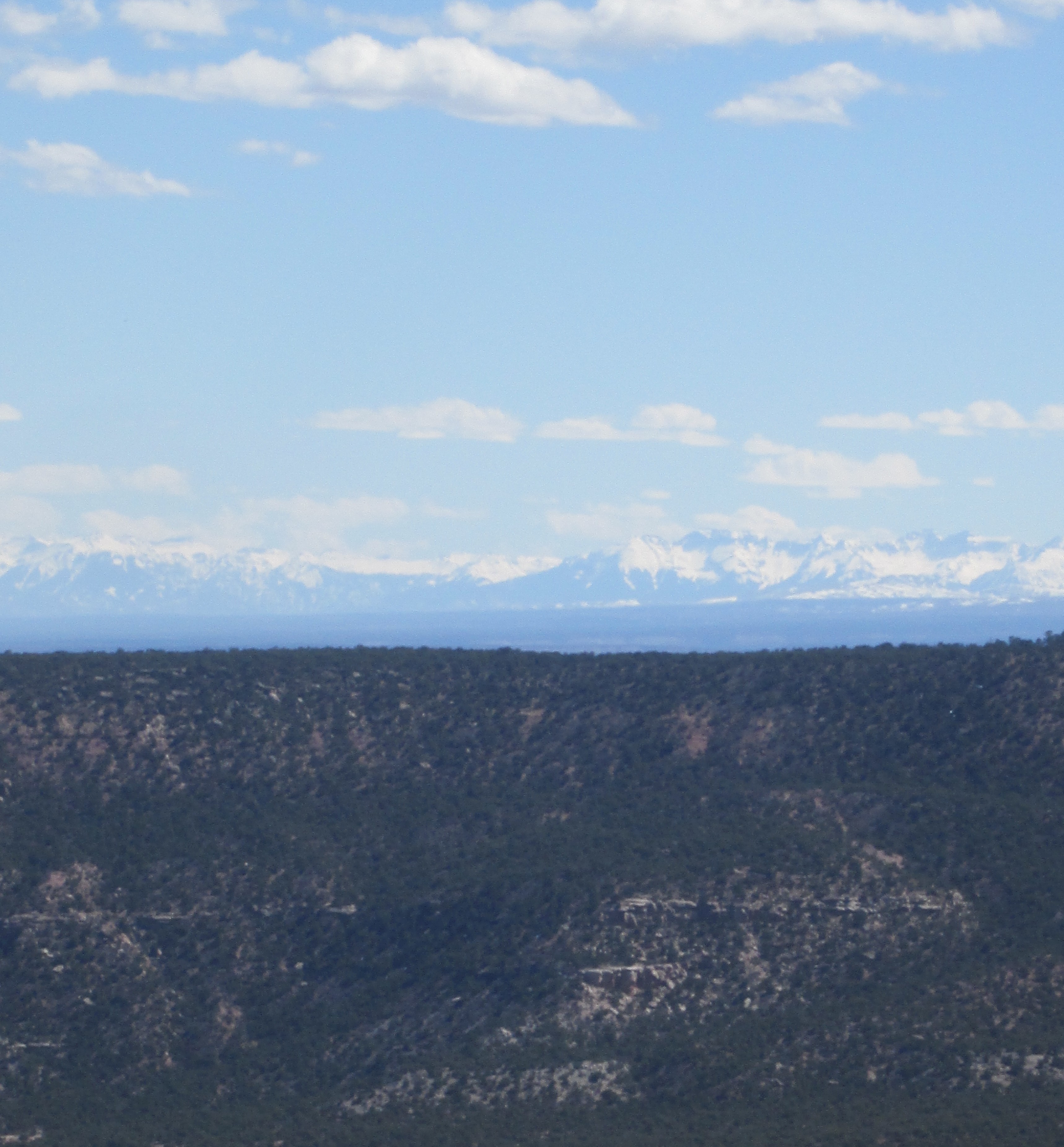
We gained 1700 feet of elevation from the Unaweep Canyon valley floor — and though a bit hazy, the majestic San Juans shimmer. Telluride is on the other side. These peaks are perhaps 80 miles away.
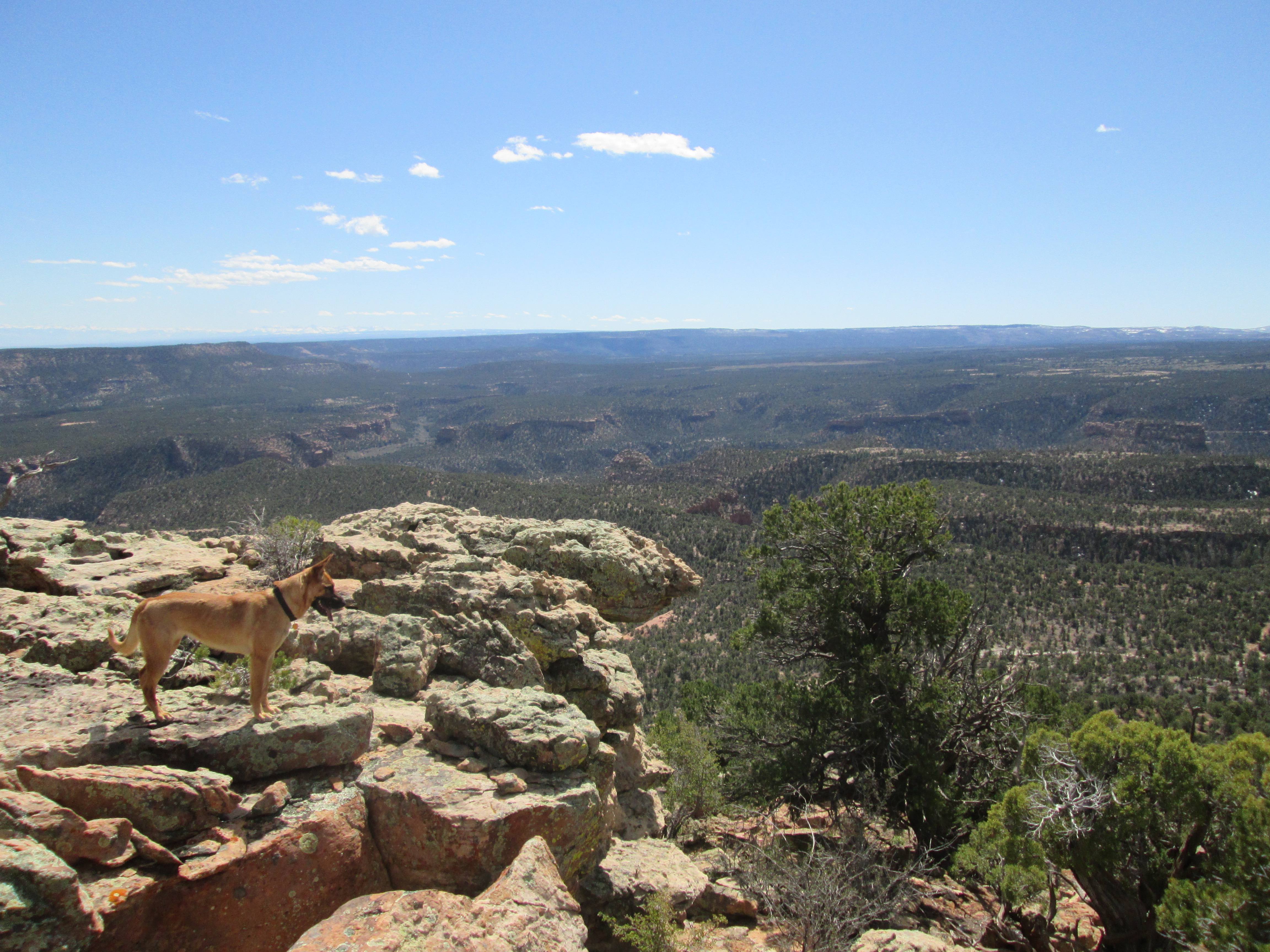
Jaja peers as we take a break at the turn-around point. We are above (due north, and up, of course) from an area locals know as “the Copper Mines.” You can make out the San Juans, but also snow on the mountains on the right horizon — the high point of the Uncompahgre Plateau.
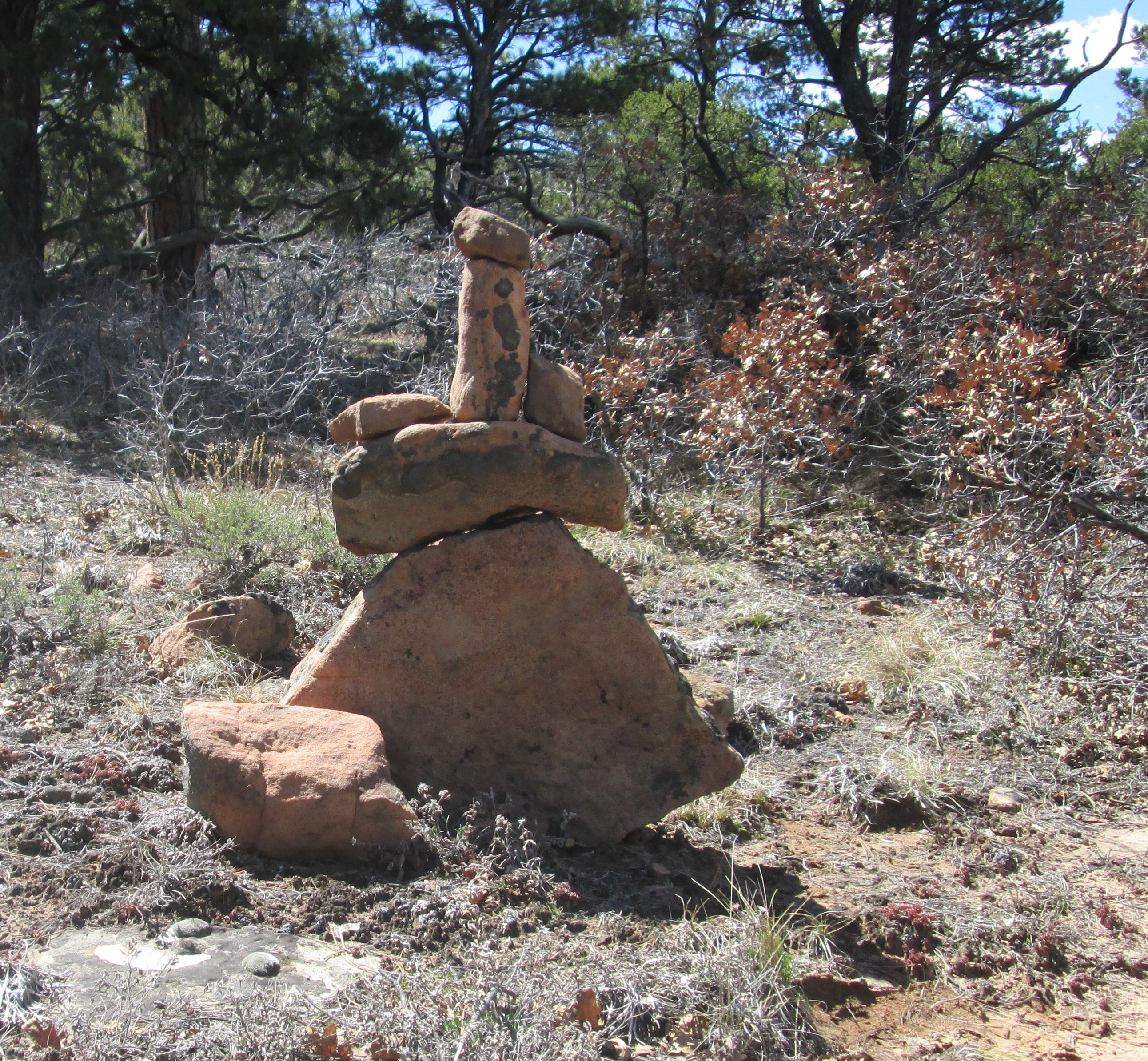
Not my best by any means, but this inuksuit is the first I made while barefoot. My rarely-used hiking boots were killing my feet!
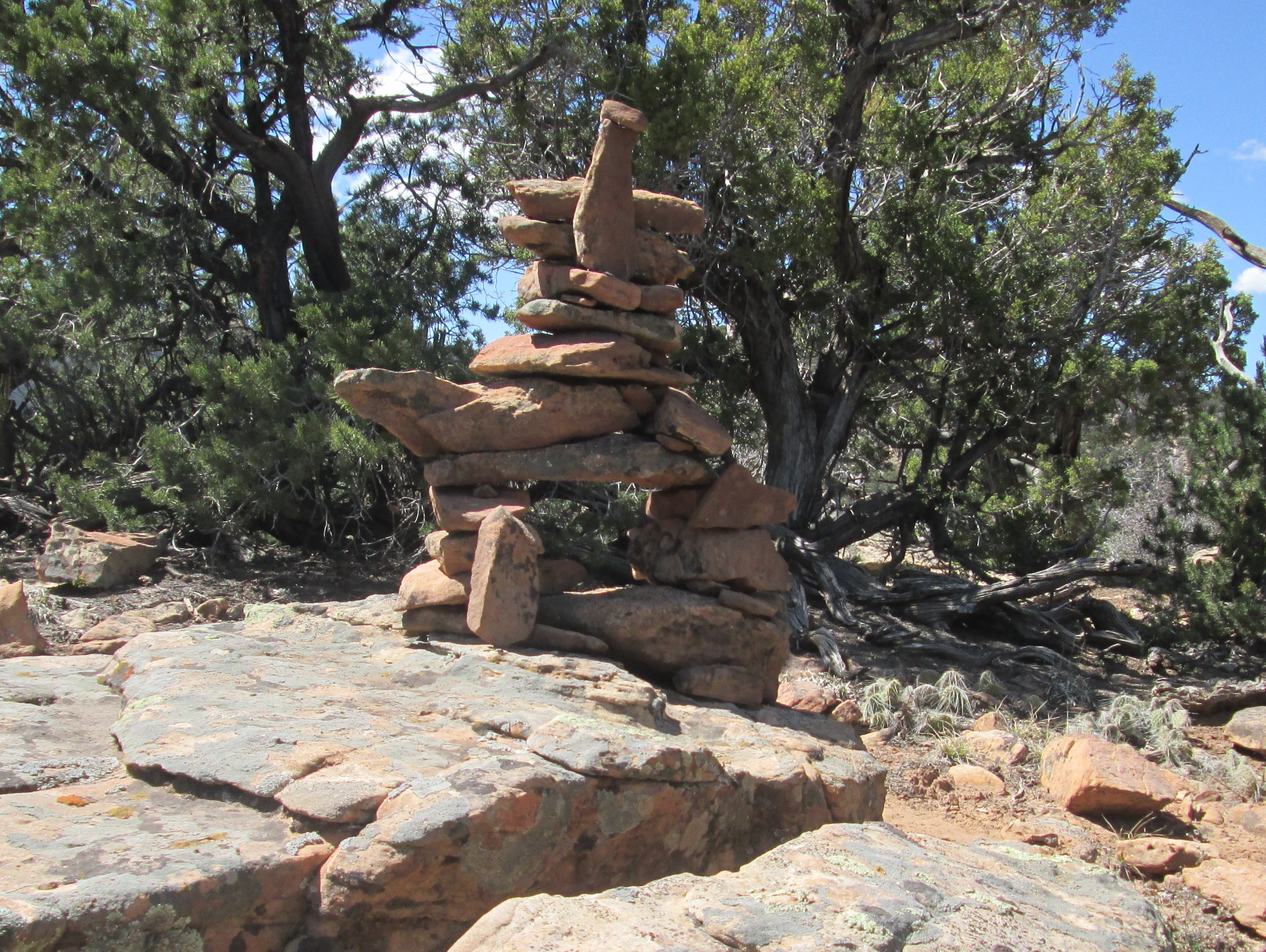
A “vee” rock.

Sometimes the rocks ask to be assembled. The triangular base, below, was sticking upright so I just accessorized it a little. No, I did NOT intend any phallic-ness.
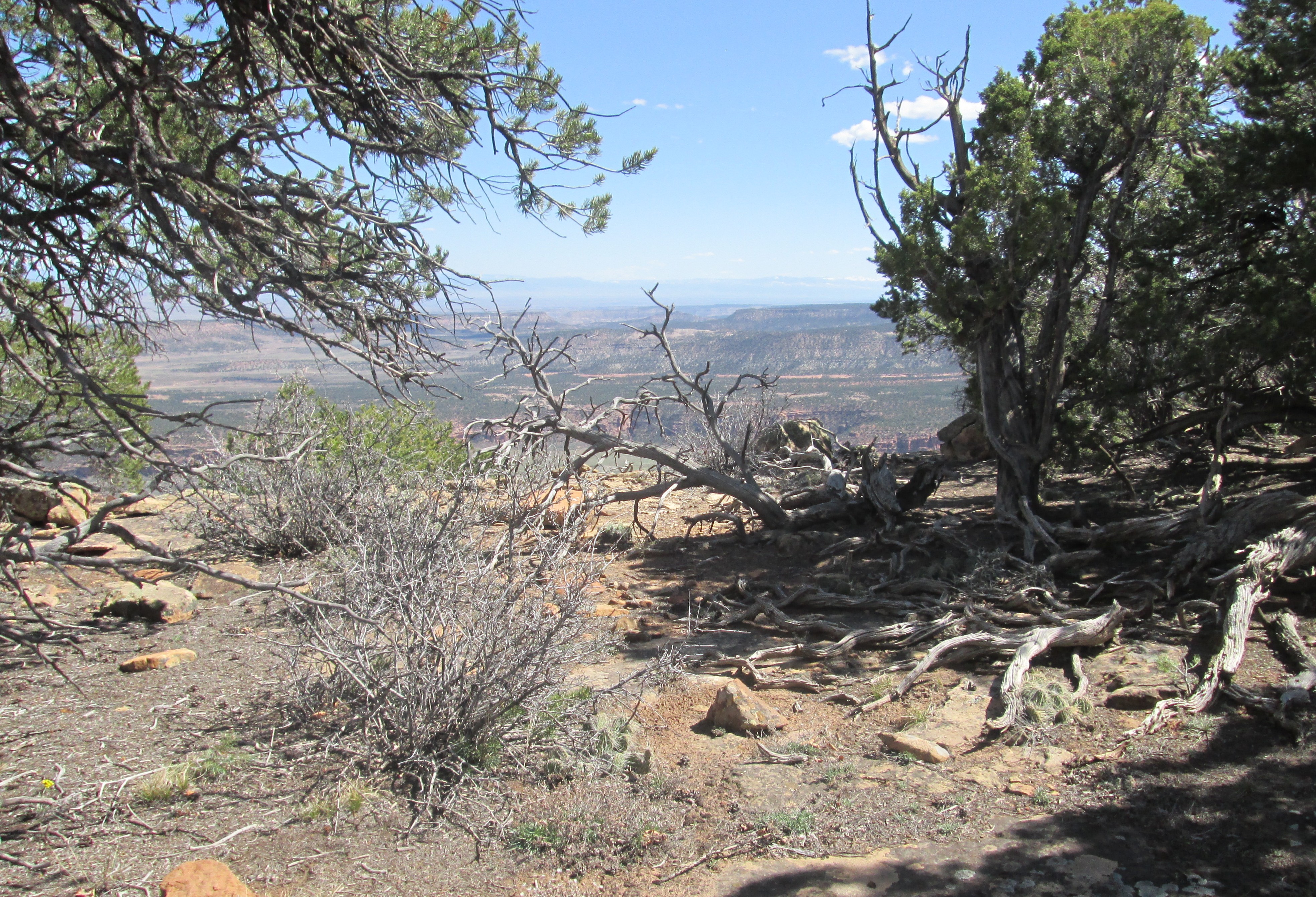
Typical edge of the uplift/cliff view. Hazy in the distance …
Zoomin’ in on the San Juans. The town of Ouray is nestled in the middle, at the base of the peaks.
Below, I would betcha that there are Anazazi signs to be found …
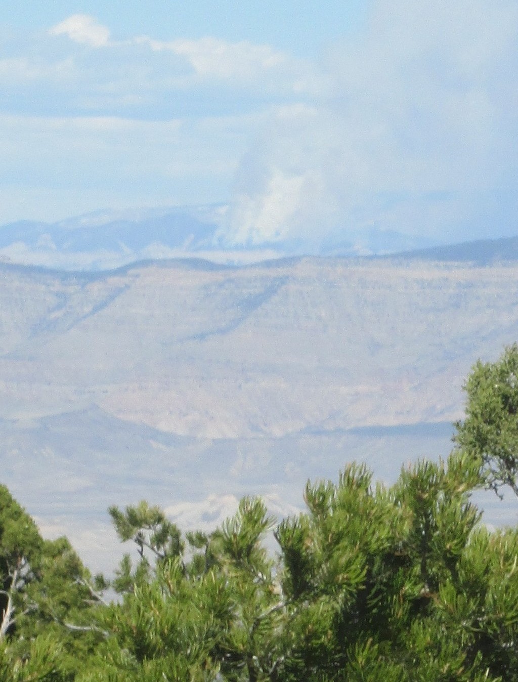
I’ve zoomed in on the left (north) shoulder — past the shoulder — of The Mesa. Is that an intentional “controlled” burn — or an accident? The night before, driving home, I saw another forest fire — well, not the fire, but the tell-tale smoke which can easily be distinguished from clouds. If we don’t get a lot more moisture, this could be yet another bad fire year …

We are most the way back to the car, and I turn for another look at the high point in the distance, which was where we hiked to. Whew!

Very beautiful! What is the wombat/cow skull thing? Who put it there and why?
LikeLiked by 1 person
there is no ‘good’ reason I put it there, 2&1/2 years ago! and there is no way I can explain why I started spelling out the “W” word with rocks many years ago. except now I try to make inuk-shuks and inuksuits instead.
LikeLiked by 1 person
Ah, you are the author of these works! I see! You have a creative endeavor of your own :)
LikeLiked by 1 person
Gorgeous. Bare feet? Where is the picture of those?
LikeLiked by 1 person
Your photographs are wonderful – such a contrast in landscape from what I’m used to. I had to google several words, but that was good too, now I know what Inuksuit are. :)
LikeLiked by 1 person
sometimes inukshuk, and ones which are “human-like” are something like innunguaq. yeah, it was pretty “up there” — as it is more “desert-y” at lower (and lower) elevations — closer to home. like I wrote, though perhaps 10 miles as the proverbial crow flies from my house, we were about 3,000 feet higher …
LikeLike
Quite a hike, then? It all looks fabulously grand in the photographs. Round here we just do ‘pretty’ apart from the Marsh which is bleak.
LikeLiked by 1 person
The line of snow capped peaks looks so much further away than – 80 miles you say? Perspective is hard for me to get while looking at pictures, or when a ball is flying toward my face. Samey samey.
The photos were gorgeous regardless. And it’s good to see your artwork has stood the test of time. Surely some archeologists will soon discover your leavings and a group of university students will be hauled in to do some ground work and research.
The dogs seemed to be having a grand time. What a day for a hike.
LikeLiked by 1 person
my primitive camera does have a “zoom” function. actually, the closest of the San Juans are about 100 mi from my house, so i have a fair idea as to distances … only twice as high as i was!
LikeLike
Wow, Your photos are gorgeous. Landscapes very beautiful and interesting in my eyes. Thank you for this post.
LikeLiked by 1 person
well, Sart, YOU enable us land-locked desert-dwellers to vicariously visit the forested sometimes wintry far north of Europe, and I try to give people a glimpse of the Amerikin “high desert” ~ ~ ~
LikeLiked by 1 person
Beautiful photos! I hope you get some rain (you can have some of ours – we have flood warnings right now).
LikeLiked by 1 person
well, you guise (engalz) “in the east” have had a heckuva winter, etc. “we” are not exactly at drought condishuns, but still “below average” for anticipated moisture, etc. DID see fresh snow on the “upper Monument” this a.m., however …
LikeLiked by 1 person
Thanks for the beautiful outing… I much enjoyed your photographs and descriptions.
All my best wishes. Aquileana :star:
LikeLiked by 1 person
well, dear, THANK YOU for your exquisite in-depth illustrated Greek mythology essays! you’re an artist AND a scholar! whereas i am an occasional rambling wanderer (or izzit it wandering rambler?)
LikeLiked by 1 person
We are all have those phases. That’s why I post twice a month . Wink ;) Thanks and best wishes. Aquileana :star:
LikeLiked by 1 person
Don’t we live in a gorgeous place!? Who could ever ask for more?
Linda
http://coloradofarmlife.wordpress.com
LikeLiked by 1 person
Lovely pictures. I adore this kind of landscape – I think it was my natural home in a previous life. Very far removed from Sweden, where I now live :)
LikeLiked by 1 person
Nice Pictures :-)
LikeLiked by 1 person
thankyou, sir !
LikeLiked by 1 person